Waterways
Explore waterways across Victoria; their history, their value, their threats, their management and their potential
Students create an early flood warning system for their town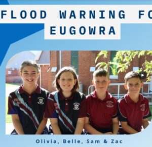
Young St Joseph’s PS students from Eugowra NSW have developed an early flood warning system for Eugowra after unprecedented floods devastated their town in 2022. They presented their project to expert adults from around the country at the Floodplain Management Australia national conference in Melbourne in May 2025. Their inspiring video is such as great example of student-led inquiry-based practical learning, community collaboration and advocacy, innovation to create an early flood warning system and a powerful way for these students to alleviate some of the trauma they lived through.
|
Kayaking down Bendigo Creek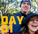
Unplug and Play was an innovative North Central CMA project created to encourage Gen Z’s to disconnect from technology and connect with the environment. The five-part documentary showcases the epic Bendigo Creek in all its forms and the natural environment that surrounds it. Kai and Jessie face all sorts of challenges along the way as drones and go-pros capture their honest reactions to the good, bad and interesting of this often-misunderstood waterway. The videos are a unique way to raise awareness of Bendigo Creek (especially beyond the urban fringe) and inspire your own students to have their own learning adventures in nature.
|
Riparian mural idea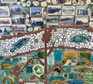
This stunning mosaic mural is found along the walking track beside the Loddon River in Bridgewater. It showcases the biodiversity and history of the river that is the heart of this small rural town. It’s made up of tiled aquatic and terrestrial flora and fauna images along with photos of iconic town buildings and important events in the life of the river; floods, droughts and infrastructure over the years. Perhaps it will give you inspiration for an art installation on your waterway?
|
Wanyarram Dhelk Bendigo Creek site signage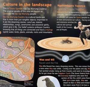
The gorgeous interpretive signs on site at Bendigo Creek’s Wanyarram Dhelk site near Knight St White Hills are a wealth of information about the cultural significance of waterways, caring for country (djandak) and water (gatjin). A visit to the site is a must do for schools in the Bendigo area. Learn more about the site by watching this video.
|
The way a creek starts to run video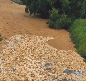
We usually see our creeks and rivers with water in them but after a dry spell they start running again from inflows. Have you ever been on site to see it ? Watch this video and be entranced by the magic of nature!
|
Coastcare Victoria Schools Kit
Coastcare Victoria has created a new education resource. The aim of the resource is to engage young people in caring for marine and coastal environments. The kit consists of a collection of video clips with simple, easy to follow lesson plans. Lesson plans include engaging activities including quizzes, games, videos, and investigation worksheets. The school kit is aimed for years 5-8. It is a flexible resource that is adaptable to younger or older audiences. To learn more about the Schools Kit watch this 45 minute webinar presented by Coastcare facilitators.
|
Tullaroop Catchment Project River Health Snapshot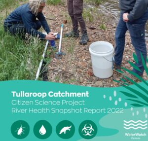
Gauge the health of waterways in the Tullaroop Catchment project area using this compilation of water quality and water bug data collected by citizen-scientists.
|
Bendigo Creek restoration video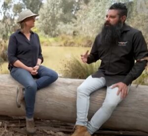
Clarence and Millie from Gardening Australia present a marvellous segment on Gardening Australia about the way Bendigo Creek is being reimagined, the way cultural knowledge is being embedded and the way we are looking to the future to bring back species and value this important urban waterway.
|
Frank Steele’s volunteer video story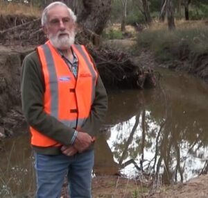
To celebrate the Waterwatch Program’s 30th anniversary, Frank Steele shares why he has enjoyed volunteering as a water quality monitor for the past 11 years. His story highlights the value in monitoring intermittent waterways and collecting photos, even in dry times, as a way of tracking change over time and measuring climate change. To read the written story click here.
|
World Wetlands Day teacher guide
Jeanie Clark, regional River Detectives coordinator in the Wimmera CMA region develops teaching resources for World Wetlands Day each year (usually held early February). The teacher guides are tailored to schools in the Wimmera region but general wetland information and activity suggestions will be useful in any region. They can be used as on-demand PD or as a guide for planning your studies of wetlands. 2022 World Wetland Day guide with theme ‘Upstream, downstream, wetlands connect us all’ 2023 World Wetland Day guide with theme ‘It’s time for wetland restoration’
|
Caring For The Campaspe Project River Health Snapshot 2021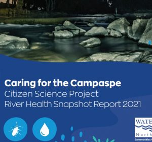
Gauge the health of waterways in the Campaspe River using this compilation of water quality and water bug data collected by citizen-scientists.
|
Kayaking the sickest urban river in Australia video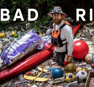
Join Beau Miles as he kayaks 23kms along Cooks River in Sydney over 4 days reflecting on it’s interesting past, it’s disturbing present and it’s hopeful future. An eye-opening journey about the plight of our littered urban waterways in modern society. ** Language warning ** Be aware some language will not be appropriate for younger viewers.
|
Trentham Golf Course benefits from A Healthy Coliban Catchment video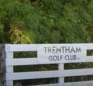
The Trentham Golf Club is keen to make a difference to their local environment, and the Healthy Coliban Catchment project is helping them achieve it. A great example of how waterways are integral to community life and we are all responsible for their health.
|
A Healthy Coliban Catchment project partnerships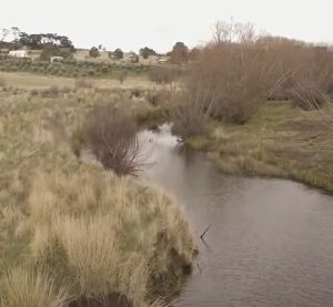
Hear about the collaboration between stakeholders to ensure A Healthy Coliban Catchment; landholders, landcare groups, traditional owners and organisations.
|
Landholders banding together for a healthier Coliban Catchment
A group of Drummond landholders are working together to help improve Kangaroo Creek, as part of the North Central CMA’s ‘A Healthy Coliban Catchment’ project. The project is working with locals to improve water quality and biodiversity of a catchment that provides drinking water for 130,000 people.
|
Bendigo Creek Citizen Science Project River Health Snapshots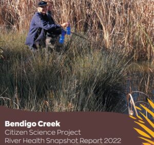
Gauge the health of the Bendigo Creek using this compilation of water quality and water bug data collected by citizen-scientists. To view and compare the 2021 report click here
|
Reimagining Bendigo Creek project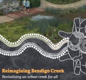
The Reimagining Bendigo Creek project is a long-term vision aiming to create a healthier, more inclusive, connected and beautiful Creek that we can all respect and value. Click the title link for details or use the project prospectus for a great summary of the issues that exist along the Bendigo Creek and the strategies to overcome them to assist Bendigo Creek reach it’s full potential.
|
Reimagining Bendigo Creek Installation video
A short video montage from an art installation in the Bendigo Conservatory celebrating what Bendigo Creek habitat provides and what it could provide in future.
|
The Bendigo Creek Story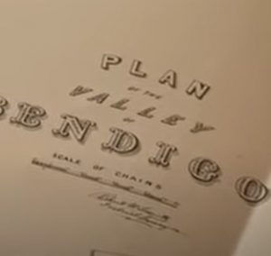
This film traces the history of the Bendigo creek to explore the savage environmental impact of mining on the local environment of the Bendigo goldfields. Features fascinating images of an 1852 unique hand-written and hand-painted map of central Victoria.
|
Healthy Coliban Catchment Project River Health Snapshots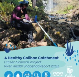
Gauge the health of waterways in the Healthy Coliban Catchment project area using this compilation of water quality and water bug data collected by citizen-scientists. You can also view and compare the 2022 or 2021 reports.
|
RiverScan Project River Health Snapshots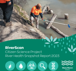
Gauge the health of waterways in the RiverScan project area using this compilation of water quality and water bug data collected by citizen-scientists. You can view and compare data in the 2021 and 2022 reports to track how things are changing.
|
Native Fish Recovery Plan Prospectus – Gunbower and Lower Loddon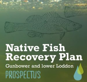
Although this document has been written for potential investors it is a great summary of the issues that exist in the Gunbower and Lower Loddon area and the strategies to overcome them. For a great example of agriculture working with environmental agencies to bring back endangered fish watch this video.
|
Caring for the Campaspe achievements brochure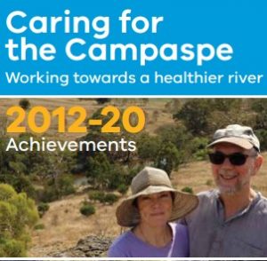
Read about the amazing achievements of this North Central CMA project from 2012-2020.
|
Taungurung Land and Waters Council and the Caring for Campaspe project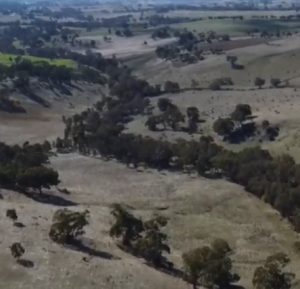
This is a great overview of the goals and benefits of the Caring For The Campaspe project, explaining to students how the NCCMA work alongside Traditional Owners and the actions they take to protect and enhance our waterways.
|
2022 Campaspe River Tour video
The Caring for the Campaspe project once again invited Traditional Owners together to spend time on Country to share, explore and learn from each other. Hear from participants about how valued this experience is.
|
Wanyarram Dhelk, Bendigo Creek site tour video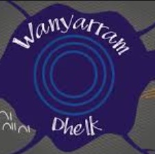
Wanyarram Dhelk is a cultural expression encapsulating what Bendigo Creek once was, a series of waterholes that provided food and fibre resources as well as recreational opportunities for Djaara people. This important project demonstrates how integrating Traditional Owner knowledge with water sensitive design can help restore cultural, social and environmental values to a degraded urban creek and is a great example for students. Wanyarram Dhelk has provided an example for the whole community of the potential to ‘Reimagine Bendigo Creek’ and embrace its possibilities as a valued natural resource. Use this case study to learn more, visit the site with your students, talk with traditional owners about the project or do some of your own ‘reimagining’. The case study can be accessed here or view this great video about the City of Greater Bendigo’s new Reconciliation Plan.
|
Barapa Water for Country video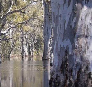
A great video to showcase the importance and value in collaborating with Traditional Owners to understand, explore and heal country by embedding cultural knowledge, skills and aspirations in land management decisions. Follow the journey of the project; See here for a look at how the project began and for more information about its goal to work with the Barapa Cultural Team and identify, map and record the cultural values of the Lower Gunbower Forest to improve the management of environmental water. See here for the 2019 video.
|
The Riparian Revegetator video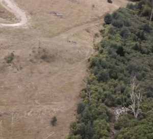
The riparian zone is the area between the land and a river or creek. Plants that thrive in this zone are known as riparian vegetation. The Riparian Revegetator tells the story of how, over the last three decades, Paul has transformed his land in Gippsland from a degraded and barren farm into a thriving environment, acting as a critical refuge for the local beasties. This is a great example of what landholders can achieve to enhance the health of waterways
|
River Moorabool movie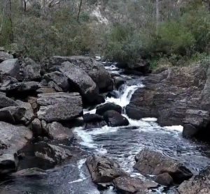
the River Moorabool was made by People for A Living Moorabool (PALM) and Sheoaks Films. It features local landowners, scientists, and healthy river advocates and explores the consequences of water demands on the Moorabool River, particularly in the face of climate change. At 48mins in length it is a compelling watch for senior students to promote deep discussions about water management issues.
|
Desert Lake – The Story of Kati Thanda – Lake Eyre picture book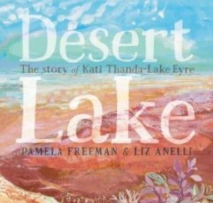
It’s raining up north and soon everything will change for the desert lake. The dry salt bed of Kati Thanda-Lake Eyre shimmers in the desert heat. But far up north, the rains have come. Water is flooding into empty riverbeds and swirling down towards the lake. Soon everything will change. Although Lake Eyre is far from Victoria, this is a beautifully written narrative that explores the unique story of one of Australia’s most amazing phenomenon. It builds an appreciation of the wonder and resilience of nature along with the function of a catchment. There are no online versions of this book but a hard copy or big book version can be ordered at your favourite book store. Alternative teacher notes can be found here.
|
Why do mass fish deaths occur ? videos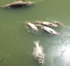
Between December 2018 and January 2019, three mass fish death events happened along a 40km stretch of the Lower Darling River, downstream of Menindee Lakes. Although this event occurred far from us in Victoria it was a highly public and very distressing event for everyone, seeing up to a million fish including 100-year-old Murray cod die in one of the biggest environmental catastrophes to hit the river. The video linked to the title above and this one here help students understand the issues around what happened. Note: views expressed are the opinion of the video producers not River Detectives or any participating CMA. And a warning that some scenes could be distressing for students.
|
Traditional life at Merin Merin wetland
Join Jaara Elder, Uncle Ricky Nelson and Professor Barry Golding as they stand together on the top of the iconic volcanic slopes of Mount Greenock and explore the life-providing Merin Merin Wetland near Clunes where kangaroos still graze, highlighting the European and Aboriginal history of the site. This video teaches students a different way to look at their local landscape with fresh eyes and appreciate its history and significance to Aboriginal people. This is one of three videos in this series. You can also watch videos about the Loddon River at Neereman and Mt Greenock.
|
Loddon River at Neereman video
Time travel back 180 years to rarely visited places and events from the early contact period that marked the beginning of unimaginable loss and trauma for Dja Dja Wurrung people. Join Jaara Elder, Uncle Ricky Nelson and Professor Barry Golding as they stand together on the top of the iconic volcanic slopes of Mount Greenock to give a fascinating insight into the history of the Loddon River at Neereman near Baringhup and the early interactions between European and Aboriginal people. This video teaches students a different way to look at their local landscape with fresh eyes and appreciate its history and significance to Aboriginal people. A must watch if you’re studying the life and times of the Loddon River. This is one of three videos in this series. You can also watch videos about Merin Merin wetland and Mt Greenock.
|
Annual Environmental/Cultural Celebration Dates
Schools and the community are invited to recognise and celebrate significant environmental / cultural days each year; some are regional, some national and some international. Many of these days tie in perfectly with the ethos of the River Detectives program and provide valuable opportunities to broaden/deepen environmental learning and encourage your students to advocate on a range of environmental and cultural issues. Check out this calendar (embedded with loads of links) and go wild !!
|
Cultural Fire and Healing Yorta Yorta Country video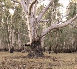
Listen to Yorta Yorta man Ralph Hume discuss cultural fire and healing country at the 2019 National Indigenous Fire Workshop near Dhungala (Murray River), Victoria, Yorta Yorta Woka (Yorta Yorta Country). A very interesting insight into how the landscape has changed since European settlement, why the riparian environment we see today is not considered healthy by traditional owners and how it can be healed.
|
Campaspe River resource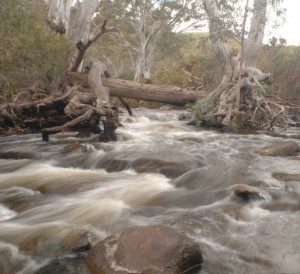
This guide is a great resource for teachers and older students to understand the Campaspe River; catchment, Aboriginal and European history, flows, health and management. Produced as part of the Caring For The Campaspe project, this guide will be a useful resource for the many schools now engaged with the project through the River Detectives program along the Campapse River.
|
Plan of the valley of Bendigo 1858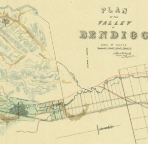
This map drawn by the District Surveyor, Richard Larritt in 1858 shows the alignment of the Bendigo Creek at the time between Kangaroo Flat and Huntly. Goldmining had already taken a significant toll on the landscape by 1858 but this map from the State Library is possibly the best evidence (besides doing archaeological digs) of the original form of Bendigo Creek. As time went on, the Creek was drastically modified to be what we see today. This is a fascinating insight for students in the Bendigo area.
|
The Water Tribe and Ochre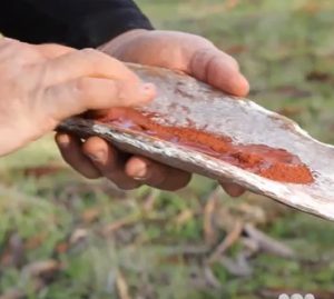
Proud Wathaurung man Barry Gilson is learning and writing songs in the language of his ancestors – a difficult task because “everything has been lost”. What does he mean by this? He also speaks of how ochre was and is used in Aboriginal ceremonies.
|
River Rehab: Protecting Waterways From Livestock video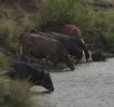
Watch this video to see how Tasmania’s farmers are taking measures to reduce degradation of the state’s waterways from livestock. This video introduces students to sustainable farming practices that protect waterways and increase farm productivity simultaneously. Draw your own farm plan and illustrate how it can be managed sustainably.
|
Edithvale-Seaford Wetland video series
These six educational videos focus on the Edithvale-Seaford Wetlands in the Melbourne Water area, exploring their fauna and flora, rich history, role in providing drainage, and the community groups who play a key role in caring for them. Get a well-rounded understanding of the wetland’s many diverse roles, by watching the full video series: Animals of the wetland Birds of the wetland Drainage story of the wetland Friends of the wetlands History of the wetland Plants of the wetland
|
Animals of the Wetland video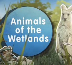
Learn how wetlands support a variety of wildlife — including birds, reptiles, frogs, fish and bugs — which are all part of a complex food web. Filmed at the Edithvale-Seaford Wetlands in the Melbourne Water area the content is true for most wetlands. This is one of six educational wetlands videos featuring the Edithvale-Seaford Wetlands.
|
Plants of the Wetland video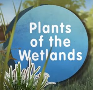
Learn why plants are important to a wetland, and how some were used by indigenous people for food, fibre and medicine. Filmed at the Edithvale-Seaford wetlands where there are 87 plant species with records of Aboriginal use, this is a great video for students in any region to understand the role wetland plants play. This is one of six educational wetlands videos featuring the Edithvale-Seaford Wetlands.
|
How the Murray River was made
Many of the waterways in northern Victoria enter the Murray River. Enjoy this re-telling of the story as it has been come to be learned by Narjiic Day-Burns.
|
Uncle Bryon Powell Interview on the Barwon River, Wadawurrung CountryIn this extended interview Uncle Bryon Powell, Wadawurrung Elder and Chair of Wathaurung Aboriginal Corporation, discusses the significance of bark canoes, the impacts of colonisation and the changes to the river landscape for Wadawurrung (Wathaurung) people, and hypothesises what life must have been like for a Wadawurrung man who helped a white domestic servant cross the Barwon River in the 1840s. Please note this is an audio interview, not video. For other cultural/historical videos, documents, photos, etc about waterways near you, type the name of your creek/river into the search bar of the Collection Search tab of the Culture Victoria website. You’ll be amazed at what you find !
|
Rick Nelson Interview at Bet Bet Creek, Dja Dja Wurrung CountryIn this extended interview Rick Nelson, Jaara descendant, is interviewed by Lucinda Horrocks on the banks of the Bet Bet Creek, in Eddington, Victoria, part of the traditional land of the Dja Dja Wurrung language peoples. Please note this is an audio interview, not video. Rick talks about how Aboriginal bark canoes were made and what they were used for in the swamps and waterways of Dja Dja Wurrung language country. He talks about the impacts of colonisation and the gold rush on the landscape on the lives of Dja Dja Wurrung people. Lucinda and Rick discuss the life of ‘King Tommy’, an Aboriginal man who lived close by, never far from the Loddon River, in the 19th century. For other cultural/historical videos, documents, photos, etc about waterways near you, type the name of your creek/river into the search bar of the Collection Search tab of the Culture Victoria website. You’ll be amazed at what you find !
|
Geographic Concepts for a Floodplain and Catchment powerpoint slides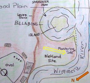
Want to know what some basic floodplain Geographic terms and concepts mean? Jeanie Clark from the Wimmera CMA put together the following three presentations to introduce the basic Geographic terms in a riverine landscape to teachers with little geographic training. Click on the links below to access each one. The slides could also be used with upper primary/secondary students. The Jeparit Showgrounds, Jeparit Primary School’s Waterwatch/ River Detectives site, was used as a local example to describe:
Jeanie is an ex-VCE Geography teacher and can be contacted through the Wimmera CMA for advice/support (time permitting).
|
Sharing culture across Wadawurrung country video
ABC’s ‘This Place’ project invites Aboriginal and Torres Strait Islander people to create a short video about a place name, and the story behind it. Bryon Powell takes us on a journey across Wadawurrung country, sharing some of the stories behind its place names. His country stretches from the mountains to the sea. It includes hills, rivers and grassy plains, creeks and coasts and includes modern towns such as Werribee, Geelong and Ballarat in Victoria. Search for other videos of cultural stories about waterways across regional Australia at the ABC TV Education website, on ABC iview or at the ABC Indigenous youtube channel.
|
Sharing culture at Barengi Djul (Wimmera River) video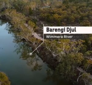
ABC’s ‘This Place’ project invites Aboriginal and Torres Strait Islander people to create a short video about a place name, and the story behind it. The Wimmera River is known as Barengi Djul in Wergaia language spoken by the Wotjobaluk people. Along the water, not far from the township of Dimboola is a special place known as Ackle Bend or Wutiyeti which means camping place, and is also known for its stories of Bunyip. Search for other videos of cultural stories about waterways across regional Australia at the ABC TV Education website, on ABC iview or at the ABC Indigenous youtube channel.
|
Seeing the land from an Aboriginal canoe video
This 10 minute video gives a wonderful insight into the way 19th century European settlers depended on Aboriginal navigators and canoe builders to transport goods, stock and people. This short documentary film explores the little known contribution Aboriginal people made in colonial times across the river systems of Victoria. It features interviews with the historian Associate Professor Fred Cahir and Traditional Owners Uncle Bryon Powell, Jamie Lowe and Rick Nelson. For other cultural/historical videos, documents, photos, etc about waterways near you, type the name of your creek/river into the search bar of the Collection Search tab of the Culture Victoria website. You’ll be amazed at what you find !
|
On The River picture story book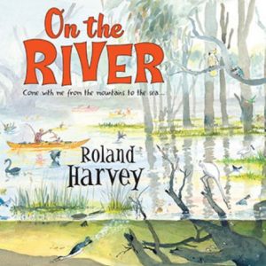
This book is a delight for all ages from the creator of the bestselling At the Beach series. Follow the mighty Murray River from its smallest beginnings in the mountains to where it meets the sea on an epic journey with Roland Harvey and his pelican friend, in this glorious picture book full of humorous, intricate illustrations and fascinating information. Together they discover the story of the river: its secrets, history, ecology, people and animals. And you’re invited, too! There are no online versions of this book but a hard copy can be ordered at your favourite book store. Teacher’s notes are available along with a worksheet for younger readers.
|
You And Me, Murrawee picture story book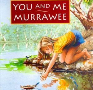
You And Me, Murrawee by Kerri Hashmi is a simple yet very powerful story for primary aged children about the rhythms of daily life beside a river and the many reasons we enjoy time by the water. It highlights the timeless appeal of rivers, the constant yet ever-evolving circle of life for people/plants/animals and prompts us to evaluate modern and traditional life through the subtle revelation that the characters are living 200 years apart. Murrawee means ‘elder sister’ in the language of the Ngarrindjeri people from the Murray River in South Australia but this story is set at an unnamed river and can be used in any location. Enjoy this online reading of the story or purchase the book at your favourite book store. Teacher notes for the story are not available but endless learning opportunities abound.
|
Rubbish In The River envirostory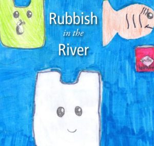
This example of a student-written/illustrated book comes from the Enviro-Stories website. It is a great example of how the River Detectives program can be embedded into the curriculum and inspire literacy projects. The topics are endless for solo/group writing challenges. Check out the enviro-story library for more ideas regardless of how books are eventually published.
|
Wilam: A Birrarung Story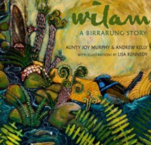
Wilam: A Birrarung Story is written by Aunty Joy Murphy and Andrew Kelly and illustrated by Lisa Kennedy. It tells the Indigenous and geographical story of Melbourne’s Yarra River, from its source to its mouth, from its pre-history to the present day and includes words from the Woiwurrung language. There are no online versions of this book but a hard copy can be ordered at your favourite book store. Comprehensive cross-curricular teacher’s notes are a wonderful guide to implementing this beautiful book in the classroom.
|
Catchment/Waterway photos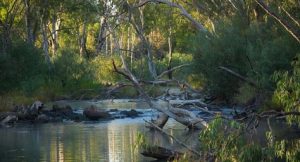
These photos of catchments, healthy and threatened waterways, wetlands and rehabilitation strategies can be used as a springboard for discussion, in conjunction with lessons in the Waterways Environmental Education Resource (see Topics-Waterways) or with some of the activities on the Waterways activity matrix found under the Dive Deeper tab.
|
Wetland Illustration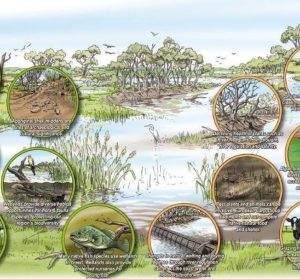
This illustration can be printed at A3 size to outline the important values of wetlands and highlight the factors that threaten their health.
|
“Rivertime” picture story book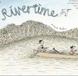
Rivertime by Trace Balla follows the adventures of Clancy who goes on a paddling adventure down the Glenelg River in the Wimmera CMA region with his bird-watching uncle. It is a story about slowing down (‘rivertime’), growing up and connecting with the land and its creatures. It’s also a fantastic launching pad for doing some birdwatching at your waterwatch site. There are no online versions of this book but a hard copy can be ordered at your favourite book store. The story can be read as a class but is best enjoyed by individuals to read and reflect at their own pace, pore over the detailed illustrations and enjoy every comic-style speech bubble. Teacher Notes provide suggested activities for middle/upper primary students or use this Rivertime-inspired pocket birdwatching guide by Trace Balla to inspire your students to make a guide for your area !
|
“The Rhythm of the Rain” picture story book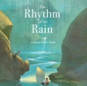
The Rhythm of the Rain by Graham Baker-Smith is a magical book for any educator to launch a lesson or a unit on the water cycle, on the geography of our planet, on the diversity on our planet…there are so many themes hidden within. This story will stretch students’ imaginations, their curiosity, their appreciation of the amazing natural world that surrounds us and nourishes us. Thanks to Alice from Coliban Water in the north central region you can watch a reading of the book as a springboard to other discussions and activities around the water cycle, catchments and the responsibility we all share around the world to conserve water for everyone. Use the links above and below this post to access your local water authority and get involved in their education resources and incursions.
|
North East CMA region map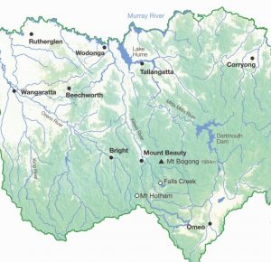
The North East CMA region is one of ten CMA regions of Victoria. This map shows the myriad of waterways that exist from the mountains to the Murray, the major towns and the dams that support them.
|
Environmental Water in Northern Victoria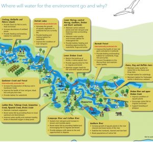
Many of Victoria’s rivers and wetlands have been modified to provide water vital for farms, homes and industry. Water for the environment also benefits communities by improving conditions for fishing, camping and canoeing. Improved water quality can have economic benefits for irrigation and urban water supply. This map shows how water for the environment will help improve and protect plants and animals in northern Victoria in 2020-21.
|
“Where’s Our Water” digital picture story book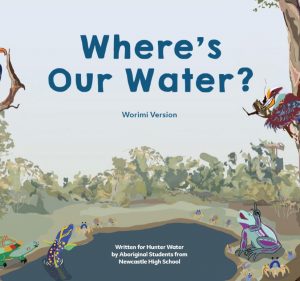
This book came out of a project co-ordinated by Hunter Water in NSW. Although it is not local, the story has valuable messages that apply to any catchment and the project is an inspiring example of what can be achieved when students work closely with traditional owners. Where’s Our Water? has been written for primary school students in the Lower Hunter region to teach them about the value of water as a precious resource and that it is everyone’s responsibility to care for it to ensure we have enough now and into the future. Hunter Water has collaborated with both the Awabakal and Worimi communities to create this new story that draws on their traditional wisdom and practices of caring for our land and waterways. You can also watch a video about the project.
|
Richardson River’s Journey posters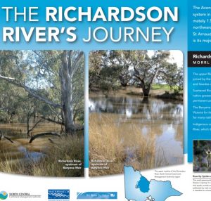
These two posters are an excellent resource for staff and students to familiarise themselves with the Richardson River – it’s; source, path, reaches, catchment, major towns, history, most notable features, flora, fauna and users. The engaging format, stunning photos and user-friendly text makes it the perfect tool for teacher background, student-lead research and learning about an important waterway in the north central region.
|
Re-snagging posters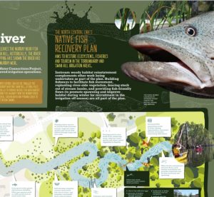
These two posters are invaluable to explain the importance of in-stream woody habitat to native fish and explains some of the important work that is taking place in the lower Loddon River and the Little Murray River as part of the north central CMA’s native fish recovery plan. Features include great photos, fact files, information and an excellent diagram outlining the threats and values in a waterway that impact on fish health.
|
Coliban River’s Journey poster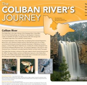
This poster is an excellent resource for staff and students to familiarise themselves with the Coliban River – it’s; source, path, catchment, major towns, history, most notable features, flora, fauna and users. The engaging format, stunning photos and user-friendly text makes it the perfect tool for teacher background, student-lead research and learning about an important waterway in the north central region.
|
Water Birds of the Loddon River poster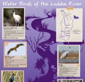
This is a wonderful poster showcasing six of the most important native water bird species of the Loddon River. It features a map of the Loddon River and its catchment and fact files on six water bird species outlining; appearance, size, life cycle, habitat, diet, breeding, behaviour, calls and conservation status. Use the Natureblitz App to listen to calls and record sightings.
|
Frogs of the Loddon River poster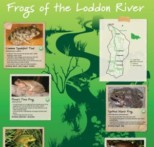
This is a wonderful poster showcasing six of the most important native frog species of the Loddon River. It features a map of the Loddon River and its catchment and fact files on six frog species outlining; appearance, size, life cycle, habitat, diet, breeding, behaviour, calls and conservation status. Use the Natureblitz App to listen to frog calls and record sightings.
|
Fish of the Loddon River poster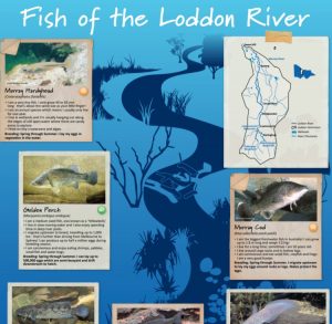
This is a wonderful poster showcasing six of the most important native fish species of the Loddon River. It features a map of the Loddon River and its catchment and fact files on six fish species outlining; appearance, size, life cycle, habitat, diet, breeding, behaviour and conservation status. Use the Natureblitz App to record sightings.
|
Avoca River’s Journey posters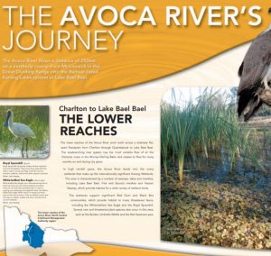
These three posters are an excellent resource for staff and students to familiarise themselves with the Avoca River – it’s; source, path, reaches, catchment, major towns, history, most notable features, flora, fauna and users. The engaging format, stunning photos and user-friendly text makes it the perfect tool for teacher background, student-lead research and learning about an important waterway in the north central region.
|
Loddon River’s Journey posters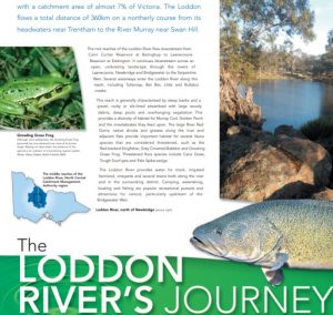
These three posters are an excellent resource for staff and students to familiarise themselves with the Loddon River – it’s; source, path, reaches, catchment, major towns, history, most notable features, flora, fauna and users. The engaging format, stunning photos and user-friendly text makes it the perfect tool for teacher background, student-lead research and learning about an important waterway in the north central region.
|
Campaspe River’s Journey posters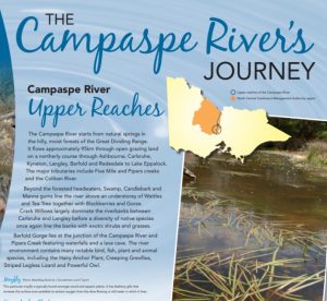
These two posters are an excellent resource for staff and students to familiarise themselves with the Campaspe River – it’s; source, path, reaches, catchment, major towns, most notable features, flora, fauna and users. The engaging format, stunning photos and user-friendly text makes it the perfect tool for teacher background, student-lead research and learning about an important waterway in the north central region.
|
Habitat Survey Data Sheet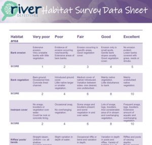
Use this data sheet on site or at school to record your habitat survey results. You can enter your habitat survey data online at the ‘Let’s Test and Record’ tab of this website.
|
Fish Need Healthy Rivers poster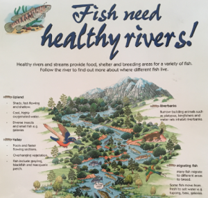
This is a great poster highlighting the features of waterways that fish require for food, shelter, breeding and migration, from source to mouth.
|
The Wimmera’s Flowing Tale video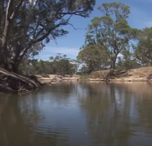
Take a journey along the depth and breadth of the Wimmera River catchment. Produced in 2006, this short film is a fantastic look back at our river system. It focusses on how Wimmera CMA looks after the catchment and how they manage environmental water releases. Although many things have changed since this film was made, such as completion of the Wimmera Mallee Pipeline and more security for environmental water releases, the themes in this flowing tale have stayed the same.
|
Bendigo Creek Citizen Science Project student presentation videos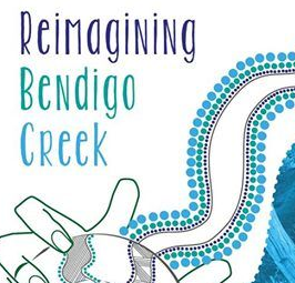
The Reimagining Bendigo Creek aims to create a healthier, more inclusive, connected and beautiful Creek that we can all respect and value. After attending a workshop in 2019 about the assets and threats of Bendigo Creek, students were challenged to present their vision for a future Bendigo Creek and their innovative results were amazing ! View Huntly Primary School’s creative lego model presentation at the title link above and Epsom Primary School’s engaging video here as inspiration for your own student-led waterway championing project.
|
Waterways Environmental Education Resource
The North Central CMA developed this package in 2002 and although it has links to the obsolete curriculum document CSF II, it is jam-packed with engaging cross-curricular activities to enhance student understanding of waterways. Primarily aimed at Year 5 and 6 students the lesson plans and activities are easily adaptable to lower primary and lower secondary. Introductory content can be found by clicking the resource title above and lesson plans/activity sheets for each curriculum area can be accessed using the links here; English, SOSE, Science, Maths, The Arts, HPE, Extras Some lesson plans refer to photos on a CD. A selection of these photos are available here.
|
North East CMAFind out what the North East CMA does and how they care for catchments in the region. Includes descriptions of the region and projects the CMA is undertaking to protect and enhance environmental values within the region. If you are in the North East CMA region you may also like to access educational support (urban water, water cycles, water conservation) from the water corporation in your specific location using this map. It will most likely be North East Water.
|
Melbourne Water education programFind out what Melbourne Water does and how they care for catchments in the region. Includes a myriad of education resources covering frogs, litter, stormwater, catchments, waterways and more. Some are specific to the Melbourne area but many are relevant to all regions. If you are in the Melbourne Water area you may also like to access support from the water corporation in your specific location using this map. It will either be Yarra Valley Water, South East Water, City West Water or Westernport Water.
|
Corangamite CMAFind out what the Corangamite CMA does and how they care for catchments in the region. Includes descriptions of the region’s catchments and projects the CMA is undertaking to protect and enhance them. If you are in the Corangamite CMA region you may also like to access educational support (urban water, water cycles, water conservation) from the water corporation in your specific location using this map; Depending on your location it may either be Central Highlands Water or Barwon Water,
|
North Central CMAFind out what the North Central CMA does and how they care for catchments in the region. Includes great descriptions of rivers and wetlands in the region and projects the CMA is undertaking to protect and enhance them. If you are in the North Central CMA region you may also like to access educational support (urban water, water cycles, water conservation) from the water corporation in your specific location using this map; Depending on your location it may either be Coliban Water, Central Highlands Water, GWM Water or Lower Murray Water.
|
Wimmera CMA
Find out what the Wimmera CMA does and how they care for catchments in the region. Includes great descriptions of rivers/streams and wetlands in the Wimmera CMA region. If you are in the Wimmera CMA region you may also like to access educational support (urban water, water cycles, water conservation) from the water corporation in your specific location using this map. It will most likely be GWM Water.
|
Wimmera Water Short Stories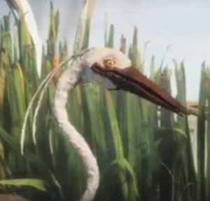
Our waterways are very special and mean something to each of us. In this series of three short stories the Wimmera CMA have been innovative and put the voices and stories of people in their region to the animated characters of the Fresh and Salty film. In Story 1 at the title link above, a tree (farmer) talks about his family being a guardian to the river over many generations. In Story 2 members of the community appear as a mosquito, fish and mollusc to tell how it feels to waterski on the river or sit beside it. In Story 3 an egret and fish share what the river means to the young and old.
|
Wimmera River at Jeparit flows into Lake Hindmarsh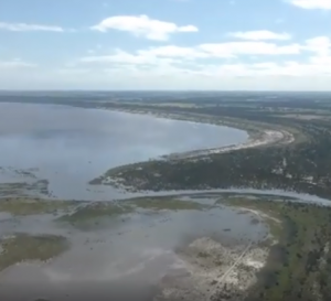
In September 2016 the Wimmera region enjoyed seeing many of their waterways flowing and lakes filling! The CMA filmed the breathtaking sight of Lake Hindmarsh from the air with the majority of the lake’s 139 square km surface area covered by water. Lake Hindmarsh is Victoria’s largest freshwater lake. Previously it filled after the 2011 floods but since then had been dry. It is a popular spot for camping, birdwatching, sailing and brings visitors from around the world. The lake also supports a diverse array of plants and animals including birds, frogs, fish and river redgums.
|
Waterways for life – healthy rivers, healthy communities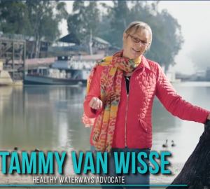
The Wimmera River in Western Victoria is where many people start or end their days, socialise, gather and be part of community events.
In this story by the Wimmera CMA join marathon swimmer Tammy Van Wisse and Wimmera locals to see just how much people rely on healthy waterways for their own physical and mental health. Healthy rivers also keep communities vibrant and alive by bringing everyone together – whether it’s for a walk, a run, a paddle, special event, fishing or just a picnic.
|
World Wetlands Day – A Wimmera Wetland video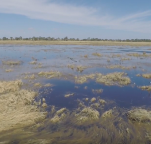
To celebrate World Wetlands Day 2020 the Wimmera CMA zoomed in on Dock Lake near Horsham that received water for the first time in two decades in 2016. They recorded the great diversity and abundance of waterbirds that flocked to the lake, showing how adding water to wetlands can trigger a huge response from nature.
|
Barwon River Planting Day video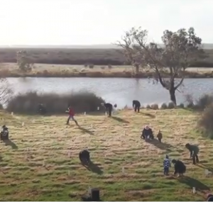
Over 40 local recreational anglers braved wet and windy conditions in July 2019 to help revegetate the Barwon River. Thousands of native trees, shrubs and grasses were planted on the banks of the lower Barwon River near Marshall, south of Geelong, to return a one kilometre stretch of the river to its original woodland habitat. This is a great example of working together to improve fish habitat.
|
Growling Grass Frog story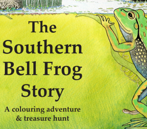
This resource from NSW Department of Planning, Industry and Environment is a colouring book and treasure hunt focused on the Southern Bell Frog (we call it the Growling Grass Frog in Victoria). It is a beautifully detailed keepsake for students looking at the habitat, life cycle, diet, call, appearance of the Growling Grass Frog and its place in the ecosystem of wetland life.
|
Woodend PS planting day video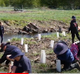
In October 2019, the NCCMA worked with Coliban Water and Dja Dja Wurrung to hold a planting day on the banks of the Campaspe River with Grade 4 students from Woodend Primary School. Students helped to plant some of the 20,000 native trees and shrubs, and learned about the positive impact the plants and fencing will have on water quality and catchment health.
|
Enhancing Dandenong Creek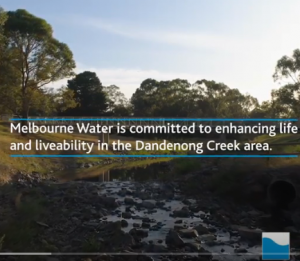
Melbourne Water’s ‘Enhancing Our Dandenong Creek’ project is taking an innovative approach to sewerage management and bringing the creek back to life. Although Melbourne based, this is a great case study to show students how urban water can be managed effectively. For more information go to Melbourne Water’s website
|
Waterway Treasure Hunt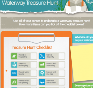
Use this activity sheet from Melbourne Water to hunt for the sights, sounds, smells and textures along a waterway near you. Draw other discoveries and reflect on how time spent at the waterway makes you feel.
|
Cohuna Fish Screens
This engaging animation clearly explains the problems that irrigation channels can cause for native fish and how fish screens are proving to be an effective solution.
|
Gunbower Forest bird breeding event video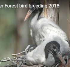
This short video shows how environmental watering programs can make a difference to the health and reproduction of water birds.
|
Barapa Wamba Water for Country River Tour 2019 video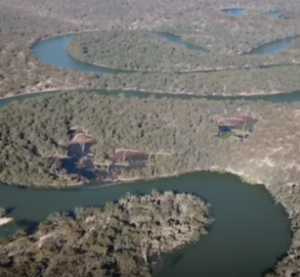
This video showcases an innovative NCCMA event for traditional owners to come together with land managers to spend time on country, learn from each other and allow time together on the river to strengthen relationships.
|
The Waterwatch Story
The North Central Waterwatch Program aims to increase the knowledge and skills of community, supporting them to become custodians of local waterways. River Detectives is the school/youth based component of the program. This video will help your students understand the community of passionate people that they belong to by being a River Detective.
|
Toxic Blackwater Explained
This video provides a simple explanation of the causes and effects of blackwater. And to learn how environmental water releases can help minimise the impacts of blackwater watch this video.
|
Water for the Environment; it’s all about timing
As well as the water in a river that naturally falls from rain, river and wetland flows are actively managed to maintain or improve their health and with the aim of achieving key ecological objectives such as:
This short video is an engaging animation that explains the issue simply.
|
Environmental Water and the Community video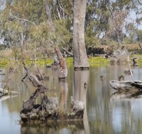
The Loddon Murray Wetlands consist of one actively managed private wetland complex and 13 public-land wetlands located on the Murray and Loddon River floodplains. The wetlands are of international and/or regional significance and collectively cover an area of more than 2,800 hectares. This video highlights the importance of environmental watering to return natural watering cycles to waterways and wetlands in the north central region.
|
Lower Campaspe Flyover video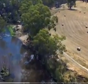
This 9 minute video shows edited footage of a drone journey along the Campaspe River from Axedale (just downstream of Lake Eppalock) to Echuca. Set to peaceful music it is a relaxing way to soar like an eagle over the waterway and start conversations about land practices along the way and strategies to balance river health with productive community life and agriculture.
|
3 Rivers Flow Indigenous Hip Hop project video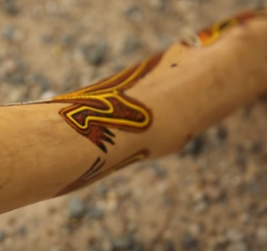
Be inspired by this awesome video of Yorta Yorta children leading their mob in a song about their country defined by three rivers; the Campaspe, the Goulburn and the mighty Murray River. Maybe you could do a similar project with your students to tell (or sing) a story about your local waterway ?
|
Caring For The Campaspe project video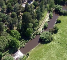
The Caring for the Campaspe project is the first large scale on-ground works project to deliver river health improvements for the Campaspe River from its headwaters near Ashbourne to the Murray River at Echuca. Since 2012, the North Central CMA has been providing fencing, offstream watering, weed control and revegetation incentives to interested land managers on both public and privately owned along the river’s length. This video is a great example of the great outcomes that can be achieved when passionate groups work together to improve river health.
|
Traditional Owner Campaspe River Tour video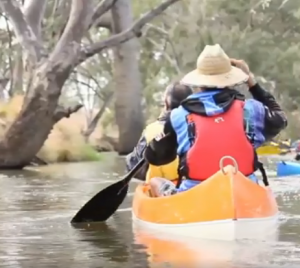
The NCCMA’s Caring for the Campaspe River project means more than just ensuring environmental values are protected and enhanced. The river has a rich cultural history and spending time there is a meaningful way for our Traditional Owners to connect with country and go on a journey of mutual learning with land managers.
|
Murray Darling Basin video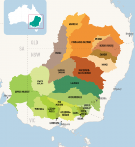
This quirky 12 minute video provides an excellent explanation of how catchments work and the animals, plants, communities and livelihoods that depend on them being well managed. It highlights the importance of balancing the needs of the environment and humans. All waterways North Central, Wimmera and North East CMA regions are part of the southern most section of the Murray Darling Basin.
|
How Wolves Change Rivers video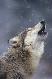
When wolves were reintroduced to Yellowstone National Park in the United States after being absent nearly 70 years, the most remarkable changes occurred. Although this is an American example, this video is a powerful example of how everything in nature is inextricably linked and one change can cause a ripple effect, in this case called a ‘trophic cascade’.
|
Riparian Zone Poster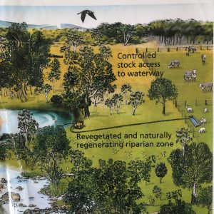
An excellent graphic to highlight the key features of a healthy riparian zone compared to a degraded riparian zone. Great for conversations about water quality, habitat health, land practices and shared community responsibility for the health of our waterways.
|
Wetlands Habitat Activity Booklet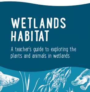
The resource contains six engaging activities for primary students to develop awareness around wetlands, wetland habitats and the importance of wetlands in our world.
|
Wimmera River Catchment map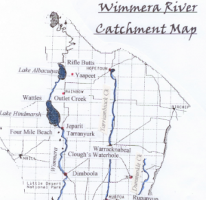
This is a map depicting the catchment area of the Wimmera River. Part of the Wimmera Catchment Management Authority region, the area to the west of the Wimmera River, doesn’t actually flow into the Wimmera River. The West Wimmera area is instead a series of wetland chains.
|
Map your River
Follow the Teachers Guide to support students to draw a birds eye view of their water testing site with captions to highlight various features. The Riparian Zone Poster could be used as an example.
|
Run of the river board game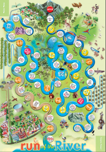
The famous Waterwatch game Run of the River can be taken into the classroom very easily: Download the Board Read the Teacher Instructions And find out How to play
|
What is a catchment?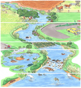
This is useful fact sheet to define and explain catchments. For more detail about how catchments and waterways are interrelated and how they can be protected see this fact sheet for older students.
|
Algae fact sheet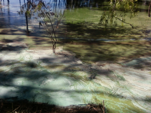
|
Stormwater fact sheet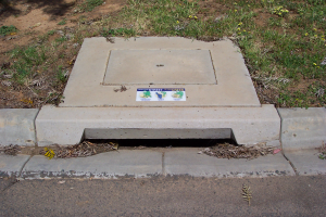
What is stormwater? Where does it come from, where does it go and what can we do to help protect our waterways?
|
Habitats near a waterway – fact sheet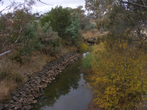
Find out about the different habitats near and in a waterway and why they are important.
|
What is the riparian zone? – fact sheet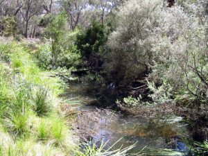
The riparian zone is any land that adjoins, directly influences, or is influenced by a body of water. Find out what the values, threats and management concerns are.
|
Blackwater Fact sheet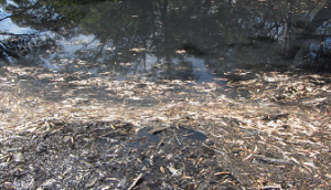
Find out about why water sometimes turns black!
|
Woody Habitat Fact Sheet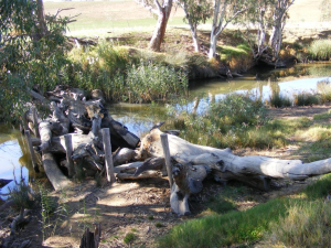
Find out what woody habitat is and why it is an important part of waterways.
|
Foam fact sheet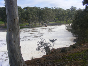
Find out how and why foam occurs in waterways.
|
Melbourne Water Catchments map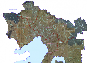
Explore the catchments of Melbourne!
|
North Central CMA Catchment maps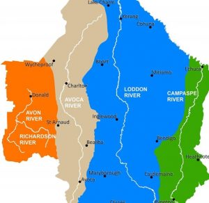
The North Central CMA region is one of ten CMA regions of Victoria. This region has four catchments; Campaspe, Loddon, Avoca and Avon Richardson. These can be broken down further into eleven sub-catchments. Click the links below to find out which catchment/sub-catchment your town/waterway is in. See it from above and understand the way water flows in your area. Upper Loddon Map; Upper Campaspe Map; Upper Avoca River Map; Lower Loddon River Map; Lower Campaspe Map; Lower Avoca Map; Loddon West Map; Loddon East Map; Gunbower Map; Coliban Map; Avon Richardson Map
|
Run of the River Game
This free App by the Murray Darling Basin Authority is educational and fun! You have the following challenge: Water is scarce and needs to be shared around. You must deliver the bubbles of water from the river to the wetlands, farms and communities, whilst keeping the river mouth connected to the ocean. Control dam releases to quench the thirst of all your water consumers through the challenges of flood, drought, evaporation, seasonal changes….
|
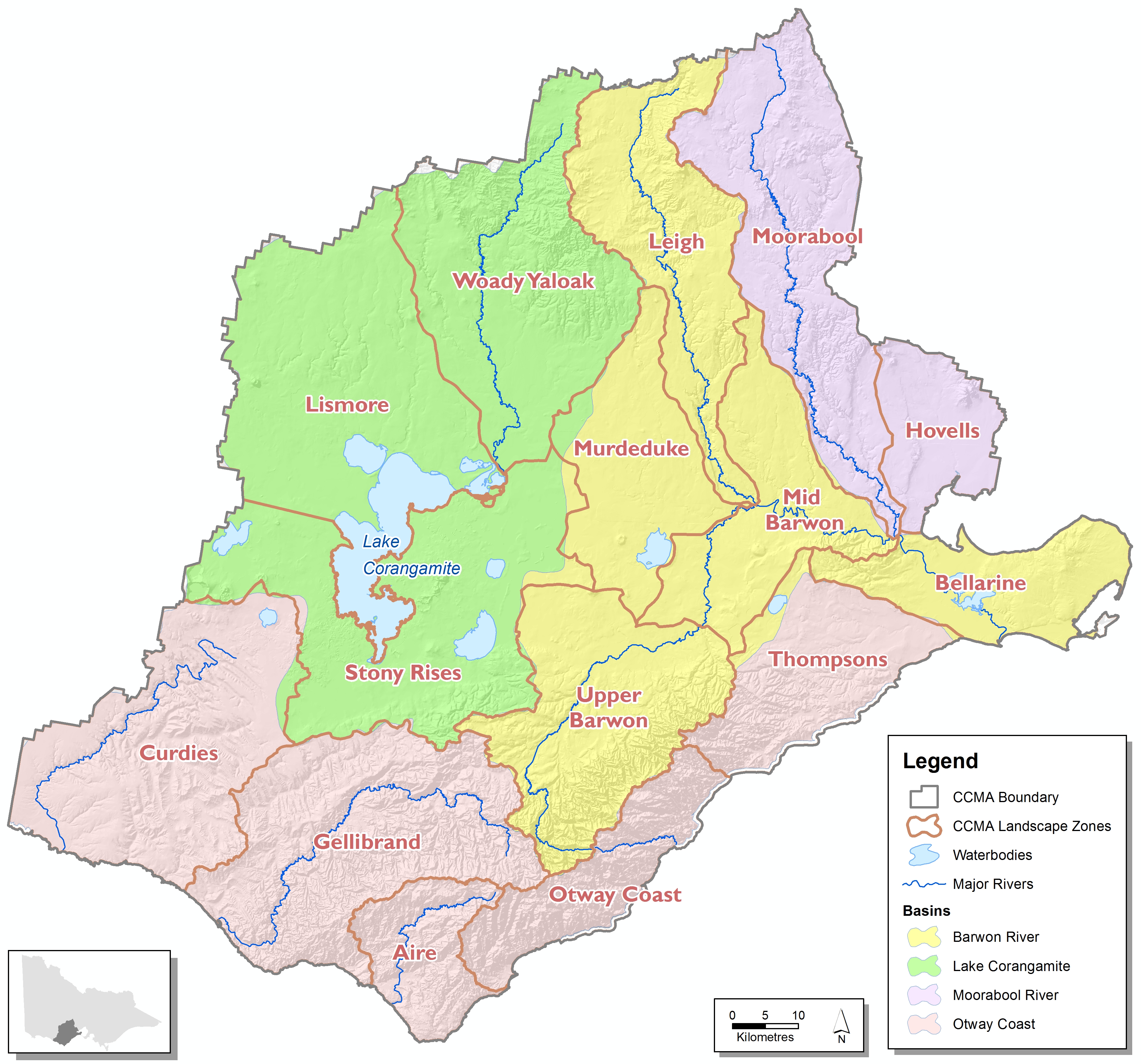
Corangamite CMA Catchment maps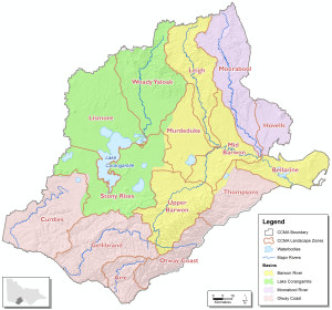
The Corangamite CMA region is one of ten CMA regions of Victoria. This region has four catchments; Barwon River, Lake Corangamite, Moorabool River and Otway Coast. These can be broken down further into fifteen sub-catchments. Click the links below to find out which catchment/sub-catchment your town/waterway is in. See it from above and understand the way water flows in your area. Moorabool, Hovells, Leigh, Murdeduke, Mid Barwon, Upper Barwon, Bellarine, Woady Yaloak, Lismore, Stony Rises, Curdies, Gellibrand, Aire, Otway Coast, Thompsons.
|
North Central CMA Region 3D map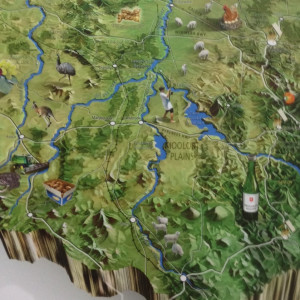
Enjoy a birds-eye view of the North Central region to understand our topography, catchments and land uses.
|
Exploring Estuaries Guide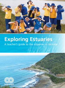
This guide provides educators with a number of lesson plans linked to the Australian Curriculum. It supports estuary-related resources designed to enhance student understanding of this important water system..
|
Nine days on Tang Tang Swamp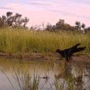
A beautiful and breathtaking secret insight into life on a drying waterhole at a public wetland located in north central Victoria
|